Class information for: |
Basic class information |
| ID | Publications | Average number of references |
Avg. shr. active ref. in WoS |
|---|---|---|---|
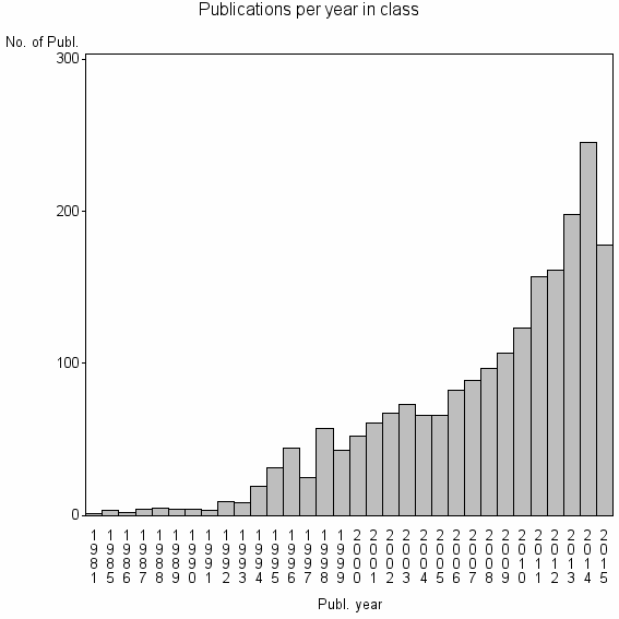
| 2736 | 2084 | 29.0 | 61% |
Classes in level above (level 2) |
| ID, lev. above |
Publications | Label for level above |
|---|---|---|
| 298 | 17998 | JOURNAL OF VOLCANOLOGY AND GEOTHERMAL RESEARCH//BULLETIN OF VOLCANOLOGY//ALASKA VOLCANO OBSERV |
Terms with highest relevance score |
| Rank | Term | Type of term | Relevance score (tfidf) |
Class's shr. of term's tot. occurrences |
Shr. of publ. in class containing term |
Num. of publ. in class |
|---|---|---|---|---|---|---|
| 1 | INTERFEROMETRIC SYNTHETIC APERTURE RADAR INSAR | Author keyword | 68 | 62% | 3% | 71 |
| 2 | SYNTHETIC APERTURE RADAR INTERFEROMETRY INSAR | Author keyword | 64 | 86% | 2% | 32 |
| 3 | INSAR | Author keyword | 55 | 26% | 9% | 183 |
| 4 | RADAR INTERFEROMETRY | Author keyword | 44 | 40% | 4% | 86 |
| 5 | SYNTHETIC APERTURE RADAR SAR INTERFEROMETRY | Author keyword | 42 | 71% | 2% | 34 |
| 6 | DIFFERENTIAL SYNTHETIC APERTURE RADAR INTERFEROMETRY DINSAR | Author keyword | 27 | 92% | 1% | 11 |
| 7 | PHASE UNWRAPPING PU | Author keyword | 27 | 92% | 1% | 11 |
| 8 | PHASE UNWRAPPING | Author keyword | 27 | 19% | 6% | 132 |
| 9 | SAR INTERFEROMETRY INSAR | Author keyword | 25 | 63% | 1% | 25 |
| 10 | SAR INTERFEROMETRY | Author keyword | 24 | 25% | 4% | 86 |
Web of Science journal categories |
Author Key Words |
Key Words Plus |
| Rank | Web of Science journal category | Relevance score (tfidf) |
Class's shr. of term's tot. occurrences |
Shr. of publ. in class containing term |
Num. of publ. in class |
|---|---|---|---|---|---|
| 1 | PERMANENT SCATTERERS | 287 | 62% | 14% | 293 |
| 2 | SAR INTERFEROMETRY | 197 | 42% | 17% | 363 |
| 3 | RADAR INTERFEROMETRY | 193 | 39% | 19% | 394 |
| 4 | INSAR | 103 | 54% | 6% | 132 |
| 5 | DIFFERENTIAL SAR INTERFEROGRAMS | 88 | 64% | 4% | 85 |
| 6 | DIFFERENTIAL SAR INTERFEROMETRY | 69 | 73% | 2% | 52 |
| 7 | APERTURE RADAR INTERFEROMETRY | 68 | 56% | 4% | 83 |
| 8 | SATELLITE RADAR INTERFEROMETRY | 62 | 42% | 5% | 113 |
| 9 | SURFACE DEFORMATION | 61 | 27% | 9% | 197 |
| 10 | LANDERS EARTHQUAKE | 49 | 35% | 5% | 114 |
Journals |
Reviews |
| Title | Publ. year | Cit. | Active references | % act. ref. to same field |
|---|---|---|---|---|
| Recent advances in SAR interferometry time series analysis for measuring crustal deformation | 2012 | 44 | 49 | 82% |
| Synthetic aperture radar interferometry - Invited paper | 2000 | 694 | 141 | 68% |
| Resolving three-dimensional surface displacements from InSAR measurements: A review | 2014 | 6 | 105 | 89% |
| A review of terrestrial radar interferometry for measuring surface change in the geosciences | 2015 | 1 | 73 | 60% |
| Radar interferometry techniques for the study of ground subsidence phenomena: a review of practical issues through cases in Spain | 2014 | 7 | 50 | 68% |
| Radar interferometry and its application to changes in the earth's surface | 1998 | 824 | 133 | 50% |
| A review of ground-based SAR interferometry for deformation measurement | 2014 | 5 | 41 | 76% |
| Atmospheric effects on InSAR measurements and their mitigation | 2008 | 35 | 59 | 86% |
| Synthetic aperture radar interferometry to measure Earth's surface topography and its deformation | 2000 | 249 | 90 | 62% |
| Synthetic aperture radar interferometry | 1998 | 475 | 84 | 44% |
Address terms |
| Rank | Address term | Relevance score (tfidf) |
Class's shr. of term's tot. occurrences |
Shr. of publ. in class containing term |
Num. of publ. in class |
|---|---|---|---|---|---|
| 1 | REMOTE SENSING GEOSPATIAL INFORMAT ENGN | 13 | 80% | 0.4% | 8 |
| 2 | LAND SURVEYING GEOINFORMAT | 11 | 14% | 3.3% | 68 |
| 3 | AREA PELIGROSIDAD RIESGOS GEOL | 11 | 78% | 0.3% | 7 |
| 4 | IST RILEVAMENTO ELETTROMAGNET AMBIENTE | 9 | 26% | 1.5% | 31 |
| 5 | DAVID A JOHNSTON CASCADES VOLCANO OBSERV | 8 | 50% | 0.6% | 12 |
| 6 | INVEST PROSPECT GEOCIENT | 8 | 50% | 0.6% | 12 |
| 7 | SAKKYO KU | 8 | 62% | 0.4% | 8 |
| 8 | LEHRSTUHL METHOD FERNERKUNDUNG | 6 | 48% | 0.5% | 10 |
| 9 | IREA | 6 | 16% | 1.5% | 32 |
| 10 | GEODESY EARTH OBSERVING SYST GRP GEOS | 6 | 100% | 0.2% | 4 |
Related classes at same level (level 1) |
| Rank | Relatedness score | Related classes |
|---|---|---|
| 1 | 0.0000140905 | SYNTHETIC APERTURE RADAR SAR//BISTATIC SYNTHETIC APERTURE RADAR BISAR//MICROWAVES RADAR |
| 2 | 0.0000117464 | LAND SUBSIDENCE//EARTH FISSURES//REGIONAL LAND SUBSIDENCE |
| 3 | 0.0000097155 | PO PLAIN//METHODS MATH MODELS SCI PLICAT//VERY HIGH RESOLUTION SEISMIC STRATIGRAPHY |
| 4 | 0.0000093132 | TEMPORAL INDICES//INTERNATIONAL CHARTER//BUILDING DAMAGE ASSESSMENT |
| 5 | 0.0000089451 | RADAR POLARIMETRY//POLARIMETRIC SYNTHETIC APERTURE RADAR POLSAR//SYNTHETIC APERTURE RADAR SAR |
| 6 | 0.0000075763 | MT ETNA//MOUNT ETNA//OSSERVATORIO ETNEO |
| 7 | 0.0000053752 | ABANDONED UNDERGROUND COAL MINE//SUBSIDENCE BASIN//MINING SUBSIDENCE |
| 8 | 0.0000051560 | PHOTOGRAMMETRIC RECORD//SATELLITE SURVEYING M PING PLICAT//SATELLITE SURVEYING M PING PLICAT SASMAC |
| 9 | 0.0000051316 | PUBL WORKS CIVIL ENGN//STRUCT HLTH CARE TECHNOL BLDG//GEODESY GEODET PLICAT |
| 10 | 0.0000050611 | LONG VALLEY CALDERA//LONG VALLEY//VALLES CALDERA |