
Mining Taxi Data to Predict Tomorrow’s Traffic
TRANSPORT RESEARCH
KTH’s iMobilityLab is tracking GPS signals from hundreds of taxis on the streets of Stockholm, building advanced computer algorithms that can look for patterns in the data to create forecasts based on weather, time of day, construction delays and more. The researchers say their model could be used in smartphone apps and urban traffic planning anywhere.
It’s only been a few years since widespread availability of satellite navigation systems and smartphone traffic applications began making life easier for drivers. For most of us, just a few days using a dynamic onboard map that displays trip progress along with colour-coded markers to show traffic conditions ahead makes it hard to imagine how we ever managed without these digital marvels. But researchers at iMobilityLab say there’s still plenty of room for improvements in the services.
Today’s navigation systems use GPS (Global Positioning Satellite) to pinpoint the position of your vehicle, while cameras mounted over roads can show how fast traffic is moving on your planned route. The image you see on your screen overlays that information with a static road map or satellite photo. “Existing services do a great job of showing real-time information, but they can’t tell you in the morning what time you should leave your office to get across town to a football stadium for an evening match when there’s rain expected in the afternoon,” says Erik Jenelius, a researcher at KTH’s iMobilityLab.
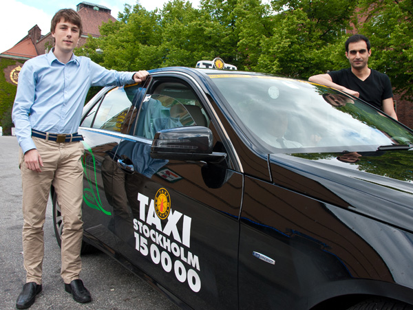
The main elements of the iMobility solution are data capture and software-based forecasting. For the data capture component, iMobility has teamed up with Taxi Stockholm to receive positional data each time the GPS systems installed in about 1500 taxis check in with the satellites. Millions of observations have been logged, stored and processed in high-powered servers financed in part by a Shared University Research (SUR) Award from the computing giant IBM. A website set up by the project lets users follow the cars through the city’s streets in real time — anonymously, of course —as new positional data is delivered. It’s intriguing to watch for a few minutes, but the really interesting part takes place when all that information is crunched into useable forms.

For that, coders on the team are working on powerful algorithms that can sort through all these positional reports, combining them with data from other sources to get a long-term picture of how traffic flow is likely to be affected by weather or disruptions such as accidents.
The iMobility model is aimed at two main application areas. The system can help give drivers better online journey planners by creating forecasts based on historical data, while at the same time building long-term visualisation tools for use by policy makers and traffic planners.
“A single report from one vehicle doesn’t say very much, but we’ve been collecting this data on a daily basis over several years so we can say a lot now about trends and characteristics in traffic. We’re figuring out how to use that information to forecast the future,” says PhD student Mahmood Rahmani, another iMobility researcher. “We’re already able to combine GPS data from mobile sources like fleet vehicles with traffic speed information from stationary cameras and radar sensors. The next step is to begin overlaying other real-time sources like weather, construction, accidents and major events. Ultimately, we should be able to give users accurate forecasts based on the day of the week, time of day and several other variables that we can include.”
Rahmani says the iMobility model will give traffic planners a tool for monitoring trends in traffic loads, an important measurement for cities like Stockholm and London that have introduced congestion charges intended to improve traffic flow in city centres. “Cities can use this kind of data to make decisions on adjusting prices for different times of day,” he says. “Stationary sensors are more expensive to operate and maintain, so taxi data could be a better option.”
Based in the Division of Traffic and Logistics under KTH’s School of Architecture and the Built Environment, the iMobilityLab project delivers research to several other institutions at KTH and other universities, and to industrial partners. The KTH-based strategic research area TRENoP (Transport Research Environment with Novel Perspectives) is a key player in this multidisciplinary collaboration. TRENoP is led by Professor Harilaos Koutsopoulos.
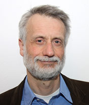
“We’re working with the Automatic Control Group in KTH’s Electrical Engineering school and [the Swedish heavy vehicle manufacturer] Scania on a system for automated platooning for large trucks,” Koutsopoulos explains. The idea is that the lorries would be wirelessly linked to a common speed control and braking system, allowing them to move down the highway in tight packs. That cuts wind resistance and fuel consumption while reducing congestion. “iMobility's role is to provide predictions of the state of traffic ahead of the platoons, sending signals to the front truck which then passes them on to the followers.”
iMobility is a member of the Mobile Millennium Project with the University of California at Berkeley, which is performing similar research on traffic in the San Francisco Bay Area, and is also partnered with the Singapore-MIT Alliance, a research collaboration among the National University of Singapore (NUS), the Nanyang Technological University (NTU), and the Massachusetts Institute of Technology (MIT). Funding has been provided by the Swedish Transport Administration and TRENoP.
By Kevin Billinghurst | kb2@kth.se