New study: high-resolution geospatial analysis for climate hazards assessment
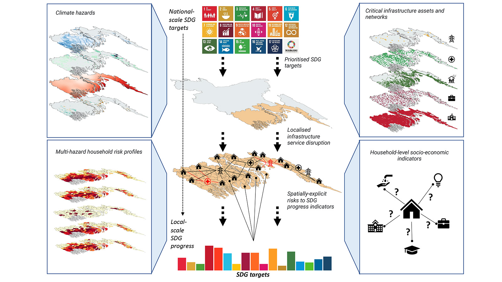
A new study in Nature Climate Change, led by KTH researcher Daniel Adshead in collaboration with partners at the University of Oxford, assesses the potential impact of climate hazards on sustainable development outcomes through a high-resolution geospatial analysis.
Poor and vulnerable communities face greater barriers to recovering from extreme weather events and may become trapped in chronic low welfare through cycles of repeated climate impacts. The study used a synthetic dataset of over 8 million households in Bangladesh's coastal zone to determine the extent to which flood, cyclone, and erosion hazards may thwart progress towards development targets by disrupting essential infrastructure services such as electricity, healthcare, education, market access, or shelter.
Based on socio-demographic characteristics of each household, the study was able to pinpoint local districts where poorer households face an 'exposure bias', that is, a greater risk of disruptions to these services. Such high-resolution analysis is useful in informing the allocation of limited resources on resilience measures at local scales.