Increased industrial thinking
Increased industrial thinking in the full value chain by coupling geodesy, geodata quality and BIM.
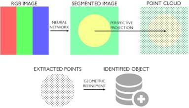
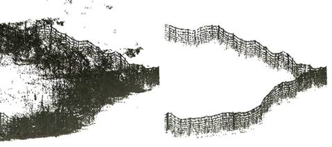
This project addresses questions that are common to the fields of geodesy and BIM and focuses on the connection between model and reality. This connection consists of geometric transformations between Euclidean and geodetic coordinate systems and interpretation of semantic information in geodata. Contributions from the project include method developments for georeferencing 3D data, new metadata to describe the characteristics of point clouds, and new methods for object identification in point clouds using machine learnin.
Funded by Trafikverket (Swedish Transport Administration).