MSc Transport and Geoinformation Technology
Sustainable cities depend on efficient transport and smart use of geospatial data. This programme equips you with expertise in transport systems and geoinformation technology, combining solid theory with modern analytical tools, including AI. With practical data expertise and an interdisciplinary understanding of mobility, geoinformatics, and sustainability, graduates face diverse career opportunities.

Transport and Geoinformation Technology at KTH
This master's programme bridges two crucial dimensions of sustainable urban development: transport systems and geoinformation technologies. These fields are deeply interconnected, as geospatial data and modeling tools are essential not only for planning, optimizing, and managing transport networks, but also for shaping resilient, efficient, and sustainable cities. The programme enables you to either specialise in one of these main subjects or develop an interdisciplinary study plan tailored to your unique background and interests. The recommended courses form a foundation for both subject areas, and you can choose a subject area by selecting the most appropriate sequence of elective courses. Most courses combine interactive lectures with laboratory work. Many also include an in-depth semester project. The courses use modern data collection instruments and quantitative modelling and processing software.
In the final semester, students apply their acquired knowledge and skills in the degree project, solving scientific or industrial problems in the main subject areas of the programme. You conduct independent investigations characterised by critical analysis and synthesis; you learn to analyse, formulate and define scientific problems, find and evaluate possible solutions and present the results in a thesis. In addition, you will gain practical training in scientific communication and presentation, both orally in seminars and in written form. You can complete your degree project either at KTH or in collaboration with a company or organization outside the university. The project is developed independently, with guidance and support from supervisors.
Transport systems
Transport systems deal with the movement of people and goods across space, as well as the socio-technical systems that support that movement. Skilled transport engineers and planners must combine elements of engineering, planning, economics, and systems analysis to guide how transport systems should be designed, built, operated, and evaluated. As a specialist in transport, you will learn how to analyse complex transport networks in which the goal is for people to carry out their daily activities in ways that support economic activity while minimising environmental impacts. You will explore digital tools like traffic simulations, digital twins of transport networks, and strategies for smart mobility, mobility-as-a-service (MaaS) and emissions reduction
Today’s transport planners and engineers must combine a high level of technical competence with engagement in policy-making and stakeholder collaboration to create systems that balance efficiency, sustainability, and social needs.
In the study of transport, we emphasise a systems approach that helps us manage the complexity of transport networks and provides information that allows society to make the best decisions about investing resources in long-lasting transport infrastructure. Nearly all of our graduates find careers in a city, regional government, national administration, transport ministry, as consultants at a private firm, or as researchers.
Geoinformation technology
Geoinformation technology, also known as geomatics engineering, focuses on collecting, managing, and analysing spatial data that is essential for sustainable urban development, transport system design, and environmental monitoring. From GPS sensors in smartphones to satellite imagery and advanced 3D city models, the field combines applied mathematics, computer science, and sensor technologies to transform multi-source geospatial data into actionable insights for informed decision-making. Graduates pursue careers in areas such as GIS, remote sensing, urban analytics, and infrastructure planning, working with both private companies and public authorities.
Geoinformation technology is a perfect choice if you are interested in applied mathematics and computer science. You will learn, theoretically and practically, how to acquire geographic data using different sensors or data sources and perform processing and analysis to produce the required solution and its visualisation. Today's and tomorrow's labour markets are growing in this sector and need experts like you. You can work as a provider, analyst, or user of spatial data and geoinformation technologies for private companies and governmental agencies.
This is a two-year programme (120 ECTS credits) in English. Graduates are awarded the degree of Master of Science. The programme is mainly offered at the KTH Campus in Stockholm by the School of Architecture and Built Environment (at KTH).
Courses in the programme
The programme courses cover transport planning, traffic simulations, transport economics, railway planning and operations and signalling systems, logistics, geographical data collection: remote sensing, GNSS, laser scanning, storing, structuring, visualisation and analysis of geographical data.
Courses in the master's programme in Transport and Geoinformation Technology


Future and career
Securing sustainable development and preventing climate change is a top priority for humanity. It can only be achieved with well-organised, well-functioning, environmentally friendly transport systems. Actual and up-to-date geographic databases are prerequisites for planning, designing and constructing all necessary infrastructure. There is great demand for experts within transport systems and geoinformation technologies in the private and government sectors.
As sustainable urban development accelerates and digital transformation reshapes cities, graduates find diverse opportunities in roles like:
- Geoinformation analyst: gathering, analysing, and reporting on geospatial data at national mapping and cartographic agencies (such as Lantmäteriet in Sweden).
- Transport planner/modeller: helping the city, regional governments or national administration to plan, design and operate transport systems and to analyse the transport effects of new developments to achieve sustainability (for example, consultant companies like Sweco, WSP, regional governments or the national transport administration, Trafikverket).
- Consultant at a private firm in areas ranging from surveying, mapping, and geoinformation processing to transport planning and traffic engineering (such as Digpro or Ramboll).
- Railways engineer; undertaking analysis and strategic planning of rail systems including infrastructure, rolling stock, timetable management, and traveller information services (for example, at SL, SJ or other railway companies, or the national transport administration, Trafikverket).
- GIS expert in urban planning, land and resource management, and environmental monitoring (municipalities, consultant companies).
- Remote Sensing expert: developing core in geospatial data processing pipelines for innovative solution (satellite data providers such as Planet, Maxar, ICEYE)


Sustainable development
Graduates from KTH have the knowledge and tools for moving society in a more sustainable direction, as sustainable development is an integral part of all programmes. The three key sustainable development goals addressed by the master's programme in Transport and Geoinformation Technology are:
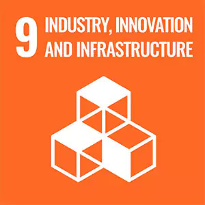


Sustainable transport and geoinformation technologies are critical to tackling climate change and building resilient, liveable cities. Transport systems today are major contributors to greenhouse gas emissions, making the shift towards zero-emission mobility one of the greatest challenges of our generation. The master’s programme equips students with expertise in designing and operating low-emission transport networks and harnessing accurate, up-to-date geographic data to inform urban planning, infrastructure development, and smart mobility solutions. Courses cover advanced methods for planning, modelling, and analysing transport systems, as well as collecting, managing, and visualising geospatial data—skills essential for finding innovative and optimised solutions to transform transport and information infrastructures into sustainable, green systems. Graduates gain the tools and knowledge to help societies transition to greener infrastructure, smarter cities, and sustainable communities, contributing directly to SDGs on climate action, sustainable cities, and innovation.
Faculty and research
The programme is given at the school of Architecture and the Built Environment . All courses in the programme are given by highly qualified teachers and researchers involved in different research projects. Even doctoral candidates are involved in teaching, mainly by helping students with lab assignments and co-supervising degree projects.
The research groups in Transport and System Analysis and Transport Planning have several ongoing research projects dealing with modelling of transport systems, policy analysis and traffic and transport planning, including public transport and railways.
The main research topics of the research group in Geodesy are geodetic aspects of BIM (Building Information Modelling) GNSS-based positioning and navigation, physical geodesy and assessment of geographic data quality.
The main focus of the research group of Geoinformatics is in the area of remote sensing and location and network analysis.
Highlighted faculty members